In the world of data analysis and business applications, understanding the geographical units such as postal codes, dissemination areas (DAs), and forward sortation areas (FSAs) is crucial. These units are more than just components of an address; they are key tools in demographic analysis, marketing strategies, and urban planning.
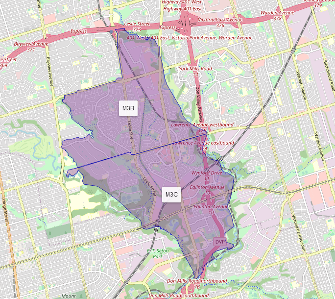
Forward Sortation Areas (FSAs): These represent the first segment of the postal code in Canada, indicating a specific area within a city or region. FSAs are particularly useful in logistics and distribution, enabling businesses to optimize their shipping and delivery strategies. In marketing, understanding FSAs can help in conducting area-specific campaigns and assessing market potential.
Dissemination Areas (DAs): DAs are small, relatively stable geographic units composed of one or more blocks. They are the smallest standard geographic area for which Canadian census data are disseminated, DAs offer a precise way to geolocate and analyze consumer demographics, spending habits, and lifestyle choices. For businesses, this translates into targeted marketing, efficient delivery routes, and strategic location planning.
Postal Codes: These alphanumeric codes are essential for mail delivery services, but their use extends far beyond. In the realm of data analytics, postal codes provide a detailed view of demographic, social, and economic characteristics at the most granular level. This level of detail is invaluable for businesses and policymakers looking to understand local trends and patterns.
The strategic significance of FSAs, DAs and postal codes in data analysis cannot be overstated. They enable businesses to segment markets, identify potential customer bases, and make informed decisions based on socioeconomic and demographic data. As we delve deeper into these concepts, it becomes evident how integral they are in bridging the gap between vast data sets and actionable business insights.
Explaining Forward Sortation Areas (FSAs)
Forward Sortation Areas, commonly known as FSAs, are an integral component of the Canadian postal code system. An FSA is the first segment of a postal code in Canada, represented by the initial three characters. This alphanumeric sequence is crucial in determining the geographic location within a city or region.
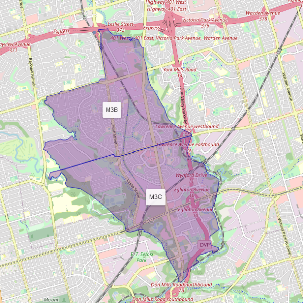
The relationship between FSAs and full postal codes is fundamental in the postal system. While a complete postal code pinpoints a specific address or small group of addresses, an FSA broadly identifies a particular area, such as a city sector, or several blocks and includes over 1700+ households. This tiered approach allows for efficient sorting and delivery of mail at various stages of the postal process.
In the context of logistical planning and market analysis, FSAs offer invaluable insights. Businesses utilize FSA data to analyze market trends and demographic patterns across different regions. This information is crucial for planning distribution networks, identifying potential new markets, and optimizing marketing strategies. For instance, a company can target its advertising campaigns to specific FSAs where a higher concentration of their target demographic resides, thereby ensuring more effective use of marketing resources.
Moreover, FSAs are also used in logistics for planning delivery routes and distribution centers. By understanding the geographical layout of FSAs, companies can optimize their supply chain operations, leading to reduced transportation costs and improved delivery times.
In summary, Forward Sortation Areas provide a versatile tool for businesses and logistics operations. They offer a broad geographical context needed for market analysis and logistical planning.
Exploring Dissemination Areas (DAs)
Dissemination Areas, commonly referred to as DAs, are uniformly sized geographic units used for the distribution of statistical data. In Canada, a DA can range from approximately 400 to 700 households and can size anywhere from larger than a postal code to larger than an FSA in rural areas, in the latter case, DAs can offer less detail than FSAs. These areas are the second smallest standard geographic units for which demographic data can be disseminated and the smallest geographic level for public datasets, making them a useful tool in statistical data collection and analysis.
The boundaries of DAs are determined based on several factors, including population density and natural or artificial boundaries (like rivers or highways). This careful delineation ensures that each DA is as demographically homogeneous as possible, allowing for accurate and meaningful data analysis.
Dissemination Areas in understanding local demographics and trends is vital. By breaking down data into these small segments, analysts can gain a detailed understanding of the socio-economic and demographic characteristics of an area. This level of data is invaluable for a range of applications, from urban planning and public policy development to market research and business strategy.
For instance, a city planner might use DA data to identify areas with aging populations to plan for adequate healthcare facilities. Similarly, a retail business could analyze DA data to determine the best location for a new store based on the demographic makeup and spending habits of the local population.
In summary, Dissemination Areas are critical in providing detailed, localized data necessary for informed decision-making across various sectors. They bridge the gap between the detailed specificity of a full postal code and the broader geographical context provided by an FSA for effective market analysis and logistical planning.
Understanding Postal Codes
A postal code is a sequence of letters and numbers added to a postal address to assist in mail sorting. In its essence, it is a part of the postal address that is used to expedite the sorting and delivery of mail. However, the utility of postal codes extends far beyond mail delivery.
The structure of postal codes varies by country. For example, in Canada, a postal code consists of six characters where letters and numbers alternate and consist of between 10 to 15 households. This format provides a highly granular level of detail, pinpointing locations down to city blocks or even individual buildings. This level of precision is invaluable in a range of applications beyond the postal service.
In demographic studies, postal codes serve as crucial identifiers that allow researchers to collect and analyze data at specific locations. They help in understanding the demographic composition, lifestyle, and socioeconomic status of residents in a particular area. This information can be used for urban planning, public health initiatives, and even political campaigns to tailor strategies to the needs of specific communities.
In marketing, postal codes are integral for targeting and segmentation strategies. They enable businesses to tailor their marketing efforts based on the characteristics of the population in a particular area. For instance, a company might use postal code information to identify areas with a high concentration of their target demographic and focus their marketing efforts more effectively in those specific regions.
Furthermore, postal codes are also used in logistics and supply chain management. They assist in route planning for deliveries, ensuring efficiency and cost-effectiveness in the distribution of goods.
Thus, postal codes, while initially designed for mail sorting and package delivery, have evolved into a multi-faceted tool essential for data-driven decision-making in all sectors, enabling the deepest dive into the characteristics of the smallest geographical segments, and providing valuable insights into local trends and demographics. Here at Manifold Data Mining, we’re proud to be the only data provider that offers all our data products down to this postal code level.
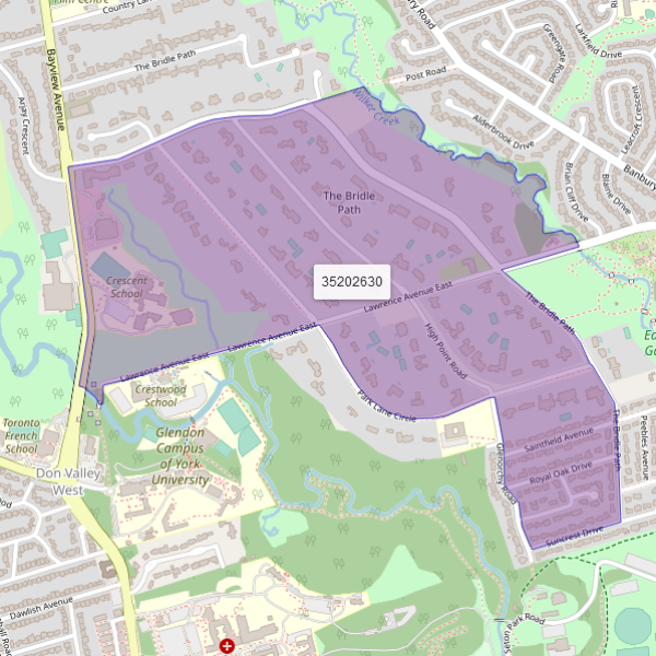
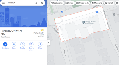
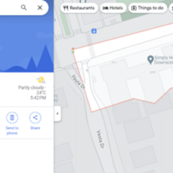
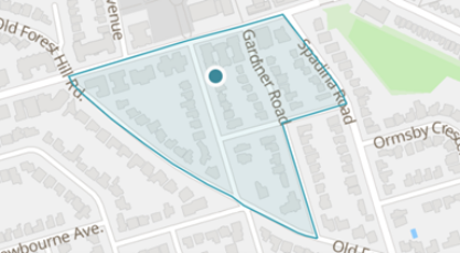
Consider the images below representing Forest Hill South in Toronto, the first image represents a DA, and the next two images represent postal codes within the DA. With postal codes, a more precise layer of data is revealed allowing you to separate all types of demographic data such as age, home value, purchasing patterns, segmentation profiles and more when they would have been otherwise aggregated together. In the case below, M5N1C6 represents a lowly rated apartment, and M5P3A9 represents homes worth upwards of $6 million dollars. When the data is put together at the DA level, a less accurate picture of the demographic profile is available which skews the understanding and strategy for this neighbourhood.
The Value of Current Year Data
With levels of geographies in mind, it is important to note that not all data sources offer both granular levels of insight and are still applicable and up to date. Access to the most recent data is essential for businesses and policymakers to make informed decisions that are relevant and effective in today’s context.
Significance in a Fast-Paced World:
- Today’s business environment and societal trends are characterized by rapid changes. From shifting consumer behaviours to evolving economic conditions, what was true yesterday may not hold today. In such a dynamic setting, relying on outdated data can lead to misguided strategies and missed opportunities, especially in Canadian cities such as Toronto where real estate development has surged, and parts of the city become unrecognizable from just a few years ago.
- Current year data provides a real-time snapshot of the market and demographic landscape, enabling businesses and policymakers to respond proactively to emerging trends and needs when everyone else is reactive.
Challenges of the Census Cycle:
- Typically, national censuses are conducted every five years with the complete publishing requiring an additional two years. While these provide comprehensive and authoritative demographic data, the interval can be a significant limitation. The data collected in public datasets become progressively less reflective of the current reality as time passes.
- This lag can pose challenges, with current year data you can respond to fast-moving economic, social, and technological trends, especially in the context of COVID-19 and mass immigration. For businesses using public datasets, this means potentially operating on insights that no longer represent the current market dynamics.
Advantages of Up-to-Date Insights:
- Having access to current year data is akin to having a real-time roadmap for decision-making. For businesses, it means being able to tailor products and services to what customers currently want and need, not what they preferred years ago. It allows agile adaptation to market shifts, giving companies a competitive edge.
- In the realm of policymaking, current data enables the crafting of policies and initiatives that address the immediate needs and challenges of the population, leading to more effective governance and community support.
In conclusion, while historical data, such as that from national censuses, forms an essential foundation for understanding long-term trends, the incorporation of current-year data is crucial for navigating the rapidly changing landscapes of today’s world. It empowers businesses and policymakers with the clarity and relevance needed for effective decision-making and strategy formulation in real-time.
Wrap-Up
In the intricate tapestry of modern industries, the understanding of Forward Sortation Areas (FSAs), Dissemination Areas (DAs), and postal codes plays a pivotal role, understanding that as the data becomes more granular, the more insightful and actionable the data becomes. These geographical markers are more than just components of an address system; they are key to unlocking a wealth of demographic and market insights. For businesses, policymakers, and researchers alike, these tools offer a window into the nuanced patterns of consumer behaviour, population dynamics, and economic trends.
The value of current, up-to-date data in this context cannot be overstated. In a world where market conditions and demographic profiles are constantly evolving, reliance on the latest data is crucial for making informed and effective decisions. Whether it’s for tailoring marketing strategies, planning urban development, or shaping public policies, the most current data ensures that decisions are relevant and impactful.
As we navigate an increasingly data-driven world, the relevance of FSAs, DAs, and postal codes extends across various sectors. From healthcare to retail, real estate to public administration, these tools provide critical insights that drive strategic decisions and operational efficiencies.
We encourage you to dive deeper into the implications of these concepts in their respective fields. Consider how a nuanced understanding of these geographical units and access to the latest data can enhance your strategies and decision-making processes and review the Manifold Data Products. All our products are available at all three geographic levels and at the current year allowing maximum flexibility depending on your particular use case.
The landscape of data analytics is rich with opportunities, and harnessing its power is key to success in today’s competitive environment. Stay informed, stay ahead, and let data guide your path to new heights.

